Kunar, the way into Nuristan
The province below Nuristan's eastern valleys, where its two rivers meet, two of its three roads begin, and the frontier of Kafiristan ran for a thousand years.
The day before Nuristan
Every journey into eastern Nuristan passes through Kunar, and most of what leaves Nuristan passes through it the other way. The cedar that built the tiered villages goes down to the timber yards of Asadabad; the walnuts, the honey and the spring morels go to its bazaar; and when someone in Waygal or Kamdesh needs a hospital, a bank or a phone signal, Asadabad is where they go. Two of the three roads into the province start there, and the two rivers that drain eastern Nuristan, the Pech and the Landai Sin, both end in the Kunar.
For a thousand years before that, Kunar was the frontier. Its valley took Islam in the eighth to eleventh centuries and the high valleys above it did not, so the villages along the Kunar river were the ones the Kafirs raided and the ones that called them kafirs. Asadabad, then called Chaghasarai, stood on the eastern edge of Kafiristan, and the Amir's army that ended Kafiristan in 1895 came up through here. This page is about that neighbour: where it is, how its roads and rivers lead into Nuristan, the Nuristanis who live in it, and its history from Alexander to the last war.
- Capital
- Asadabad, where the Pech meets the Kunar
- Population
- About 545,000 (2025 estimate)
- Districts
- Sixteen, from Nurgal to Nari
- Rivers
- The Kunar, from Chitral, and the Pech, from Nuristan
- Peoples
- Pashtun, with Nuristani, Pashai and Gujar minorities
- Nuristani villages
- The Tregam valley and the lower Pech
- Roads into Nuristan
- Two of the three: up the Pech, and up the Kunar
- From Jalalabad
- 80 km to Asadabad; a full day on to Parun
Lower, warmer, and along one river
Kunar is the province in Afghanistan's far east, wedged between Nuristan to the north, Laghman to the west, Nangarhar to the south and the Pakistani border along its whole eastern side. It is 4,339 square kilometres with about 545,000 people, almost all of them Pashtun, from the Safi, Mohmand, Shinwari and other tribes, with small Nuristani, Pashai and Gujar minorities. Pashto is the language of nine villages in ten; the rest speak the Nuristani languages, Pashai, and the small Indo-Aryan languages of the border valleys, Gawar-Bati and Dameli among them.
The Kunar river gives the province its shape and its name. It rises in the mountains of Chitral, where it is the Chitral river, crosses the border below Arandu, and runs the length of the province from north to south, past Nari, Asmar and Asadabad, before it joins the Kabul river at Jalalabad. Along the way it takes in the two rivers of eastern Nuristan: the Landai Sin, which comes down the Bashgal from Bargi Matal and Kamdesh, and the Pech, which comes down from Parun and Waygal. Asadabad, the capital, sits at the second of those meetings, 827 metres above the sea and 80 kilometres by road from Jalalabad, a town of about 42,000 people with a bazaar of several hundred shops and the timber yards where Nuristan's cedar is sawn.
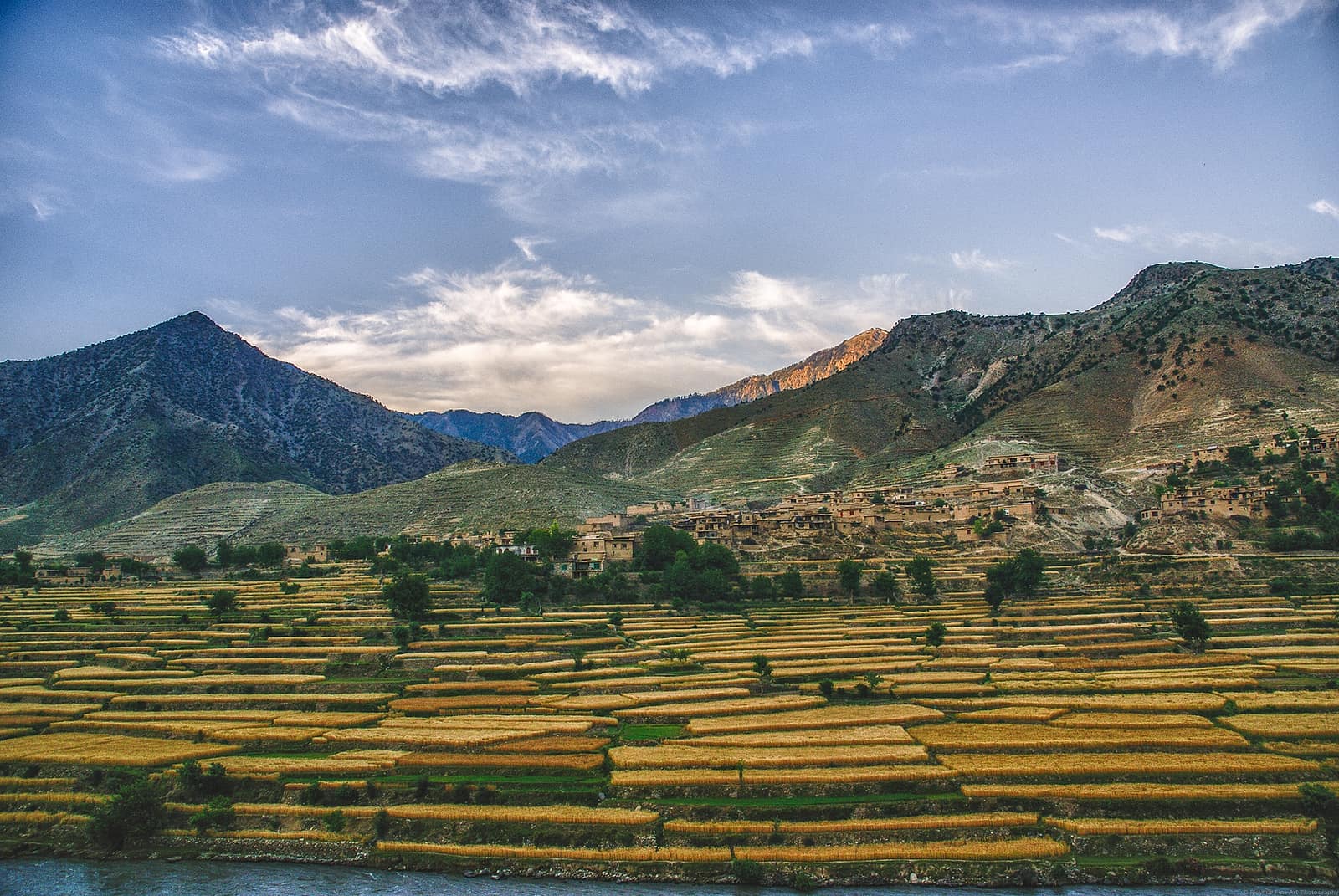
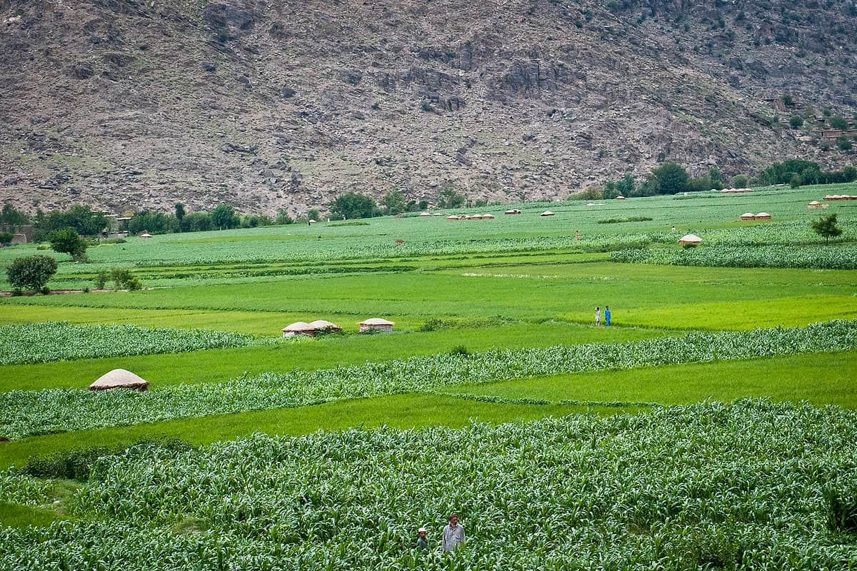
Kunar is lower, warmer and more open than Nuristan. The valley floor grows wheat, rice, maize and sugar cane, and the hillsides above are terraced and, higher up, forested. Eighty-six per cent of the province is mountain, and the side valleys that run up towards Nuristan, the Pech above all, are as steep as anything in the province above them.
Two rivers, two roads
Nuristan's eastern rivers end in the Kunar, and the two roads that follow them up are how most visitors reach the province. The numbers on the map match the cards on the How to Get page.
The Pech is Nuristan's river before it is Kunar's. It rises among the glaciers of central Nuristan, gathers the Parun and the Kantiwa, and enters Kunar at the foot of Wama. At Nangalam, the largest town on it, the Waygal river comes in from the north, and from there the Pech runs south-east through Watapur, Manogai and Chapa Dara to Asadabad. The Pech valley road follows it the whole way: a paved road from Asadabad to Nangalam, then a mountain road up past Wama to Parun. This is the first of the three roads into Nuristan, and the one most visitors take. From Asadabad, allow a full day to Parun.
The second road runs north up the Kunar river from Asadabad, past Asmar and towards the Pakistani border, to the point where the Landai Sin comes in from the west. There it turns up the Bashgal valley to Kamdesh and on to Bargi Matal at the head of the valley. This is the road to Kati and Kom country, the valleys Robertson described, and it is longer and rougher than the Pech road once it leaves the Kunar.
Both roads have a history. The Pech road was rebuilt in the 2000s, during the American war, when the valley was one of the most fought-over places in the country; the bases that lined it, Camp Blessing at Nangalam among them, have been closed for years now. The Kunar river road is older, the trade road between the Kunar and Chitral that Nuristan's timber and Chitral's goods once shared. The border at the top of it, at Arandu, is not open to travellers, so for visitors the road ends where the Bashgal begins.
Three villages, a bazaar, and a hundred years of trade
The official count puts Nuristanis at under one per cent of Kunar's people, three or four thousand, and the real figure is certainly higher, because the count follows the provincial line and Nuristanis do not. Three villages in the Tregam valley, off the lower Pech in Watapur district, speak Tregami: Gambir, Katar and Devoz, about 3,500 people in 2011, speaking the smallest of the five Nuristani languages and the closest to Waygal's, with which it shares three words in four. Tregami is severely endangered, giving way to Pashto in the shops and schools of the valley, and it is the one Nuristani language spoken entirely outside Nuristan.
They are not alone. Ashkun and Kalasha-ala are spoken in villages on Kunar's side of the line where the Pech and its side valleys cross it, Zemiaki, a small language grouped with Kalasha-ala, by a few hundred people in the same country, and Nuristani families have settled in Nangalam and Asadabad for trade and work for as long as there have been roads. The name of Dam Kelay, a village near the capital, is a Waigali name. Asadabad's bazaar has bought Nuristani walnuts and timber for a century.
The traffic runs the other way as well. Kunar's Pashtuns are Nuristan's shopkeepers, drivers and, in the lower districts, neighbours, and Pashto is the second language of almost every Nuristani because of them. The two provinces were one administration for most of the twentieth century: until the 1980s the eastern valleys of Nuristan were governed as districts of Kunar, and the provincial line that separates them today was drawn in 1993 and redrawn in 2004.
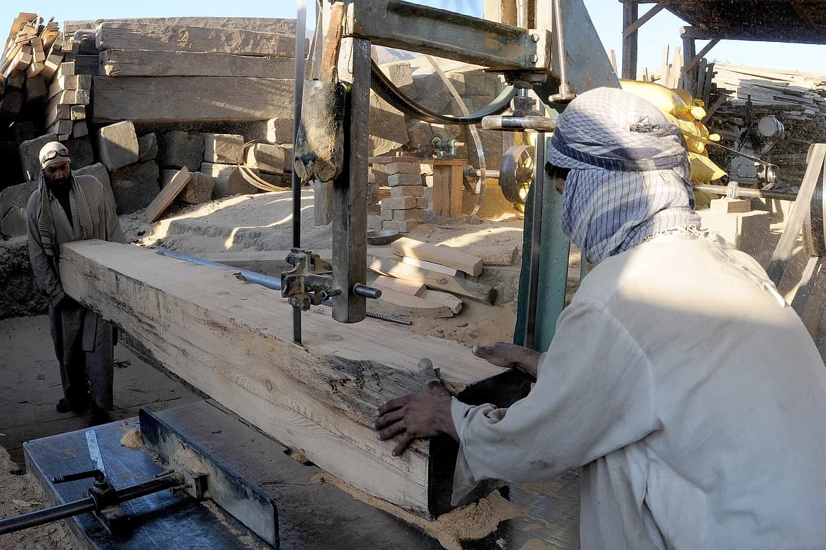
A sawmill in Asadabad. The beam is cedar, and cedar of that size comes from one place.
A thousand years on the frontier
Alexander came this way. In the winter of 327 BC his army fought its way through the Kunar valley on the road to India, and the peoples of the mountains above watched it pass; whether any of it stayed is a question our history pages leave open. From the tenth century the valley was Muslim, ruled from Ghazni and then from Kabul, and from then on the Kunar and the Kafir valleys above it lived in a state of low war that lasted nearly a thousand years: the Kafirs came down to raid, the villages of the Kunar armed against them, and the Amirs of Kabul sent columns up the side valleys that never held them. Babur passed through in the early 1500s and wrote down the Kafirs and their wine.
The end came through Kunar. In the winter of 1895 to 1896 Amir Abdur Rahman Khan's army entered Kafiristan from several sides at once, and the eastern columns came up from the Kunar into the Bashgal and the Pech. Within a generation the Kafir raids were a memory, Nuristanis were coming down to Asadabad to trade, and the frontier that had defined both provinces was gone.
The last century brought two more wars through the valley. In the 1980s and early 1990s Kunar was the seat of a Salafi emirate under Jamil al-Rahman, with money from the Gulf, and the stricter reading of Islam it preached spread up the Pech and the Bashgal and is part of why the eastern valleys of Nuristan are the way they are today. After 2001 the Pech and its side valleys, the Korengal above all, became one of the hardest places of the American war, and the outposts at Wanat in Waygal and Keating in Kamdesh were reached and supplied through Kunar. Since 2021 the valley has been quieter than at any time in forty years, and the roads through it are open to visitors again, with the province's guides.
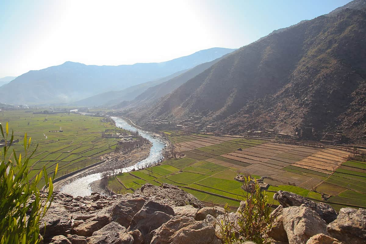
The Pech in Watapur district, where the Tregam valley opens and where the road to Wama and Parun begins to climb.
Kunar is the day before
For anyone going to Nuristan, Kunar is the day before. Asadabad is the last town with a bank, a proper hospital and a reliable phone signal, and the place to buy what you forgot; its bazaar is worth an hour, and the timber yards along the river are where you will see the cedar that built the villages you are about to visit. The confluence of the Pech and the Kunar is a short walk from the centre. From Asadabad the Pech road is paved as far as Nangalam, where the Waygal valley opens to the north and the mountain road begins.
Kunar is not a destination in the way Nuristan is, but it rewards a slower passage: the river villages, the rice terraces, the old trade road north towards Chitral. Our guides are from Nuristan and drive this road every season; conditions change with the weather and the news, and we tell you what they are before you travel, not after.
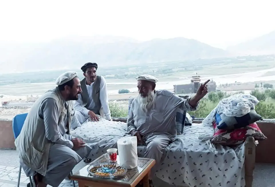
Obaid with an elder and a tribal leader of Kunar, the elder pointing out across the river plain. Our own photograph.
Asked about Kunar
Is Kunar part of Nuristan?
No. Kunar and Nuristan are neighbouring provinces. Kunar lies below Nuristan to the south and east, along the Kunar river, and its capital Asadabad is the town Nuristan's eastern valleys depend on. Until the 1980s the eastern valleys of Nuristan were governed as districts of Kunar, which is why the two are so often confused.
What is the capital of Kunar?
Asadabad, a town of about 42,000 people at the meeting of the Pech and Kunar rivers, 80 kilometres by road north-east of Jalalabad. It was historically called Chaghasarai.
How do you get from Kunar to Nuristan?
By one of two river roads from Asadabad. The Pech valley road runs west through Nangalam to Wama and up to Parun, the provincial capital, a full day's drive. The Kunar river road runs north, then turns west up the Bashgal valley to Kamdesh and Bargi Matal. The third road into Nuristan, up the Alingar, starts in Laghman instead.
Is the Pech valley in Kunar or Nuristan?
Both. The Pech rises in central Nuristan, gathers the Parun and Kantiwa rivers, and enters Kunar at the foot of Wama. Its lower valley, with Nangalam, Watapur, Manogai and Chapa Dara, is in Kunar, and it joins the Kunar river at Asadabad.
Which languages are spoken in Kunar?
Pashto, overwhelmingly. The Nuristani languages Tregami, Ashkun, Kalasha-ala and Zemiaki are spoken in villages along the lower Pech and its side valleys, Pashai in the west, and the small border languages Gawar-Bati and Dameli in the east.
Where is Tregami spoken?
In three villages, Gambir, Katar and Devoz, in the Tregam valley off the lower Pech in Kunar's Watapur district: about 3,500 people in 2011. It is the smallest of the five Nuristani languages, the closest to Waygal's Kalasha-ala, and the only one spoken entirely outside Nuristan province.
Where does the Kunar river come from?
From the mountains of Chitral in Pakistan, where it is called the Chitral river. It crosses into Afghanistan below Arandu, runs the length of Kunar province past Asmar and Asadabad, takes in the Landai Sin and the Pech from Nuristan, and joins the Kabul river at Jalalabad.
On this site
- How to get to Nuristan: the three roads in, step by step
- Chitral and the Kalash, over the passes at the top of the Kunar
- The Nuristani languages, including Tregami
- Waygal district, up the valley from Nangalam
- Kamdesh district, up the Bashgal from the Kunar
- Tours, including a tour of Kunar
- All of Nuristan's neighbours, with the map
- Wikipedia: Kunar Province (area, population, districts, peoples, languages, history)
- Wikipedia: Pech River (course, Nangalam, the bases of the American war)
- Wikipedia: Asadabad, Afghanistan (population, elevation, the old name Chaghasarai)
- Wikipedia: Tregami language (the villages of Gambir, Katar and Devoz, speaker numbers)
- Combating Terrorism Center at West Point: The First Islamic State, on Jamil al-Rahman's emirate in Kunar
- George Scott Robertson, The Kafirs of the Hindu-Kush (1896), on the Kafirs and the Kunar
Photographs
- Terraces and village in Nari district: photograph by R9 Studios FL, CC BY 2.0, via Wikimedia Commons
- Fields in the Pech valley, July 2011: U.S. Army photograph by Sgt. 1st Class Mark Burrell, public domain, via Wikimedia Commons
- A sawmill in Asadabad, November 2009: U.S. Air Force photograph by Master Sgt. Brian Boisvert, public domain, via Wikimedia Commons
- Watapur district and the Pech, January 2012: U.S. Army photograph by Sgt. Trey Harvey, public domain, via Wikimedia Commons
The photograph of Obaid with an elder and a tribal leader of Kunar is our own. The others are used under their licences until we have more of our own from Kunar.
Plan your Nuristan journey
Ready to plan a visit, source Nuristani products, or discuss an investment? Your message goes to Obaid, who is from Nuristan, and his team in Afghanistan and the UK. We reply to every message.