Nuristan weather and climate
Snow from November to April, warm green summers, and the edge of the monsoon in July and August.
A mountain climate with real winters
Nuristan has a mountain climate with real winters. The villages sit between about 1,000 and 2,900 metres, three-quarters of the province lies above 3,000, and from December to March the high valleys are under snow and often cut off. Summers are warm and green. The east of the province catches the edge of the Indian monsoon in July and August, which is why it is forested and the rest of Afghanistan mostly is not.
This page gives the long-term picture: temperatures, rain and snow month by month, what each season is like, and when to come. It is not a forecast. No weather station has kept a long record inside Nuristan, so the figures for the valleys are modelled from global weather data, and we say which numbers are measured and which are not.
- Lowest point
- About 980 m, where the Alingar river leaves Nurgaram
- Highest point
- About 6,250 m, on the northern divide
- Parun, the capital
- About 2,500 m
- Coldest month
- January: about -2°C by day, -10°C at night in Parun
- Warmest month
- July: about 25°C by day, 15°C at night in Parun
- Wettest time
- February to April, with a second peak in July and August
- Snow
- November to April in the high valleys
- Best months to visit
- June, September and early October
What decides the weather in a valley
Two things decide the weather in any Nuristani valley: how high it is, and how far east. Height sets the temperature. As a rule of thumb it falls by about six degrees for every thousand metres climbed, so Parun at 2,500 metres is ten to fifteen degrees colder than Asadabad on the Kunar river, year round, and the passes are colder again.
East and west decide the rain. Most of Afghanistan gets its rain and snow in winter and spring, from storms that come in from the west, and has dry summers. Nuristan gets that too. But the eastern highlands are the one part of the country directly reached by the moist air of the Indian monsoon, and in July and August it brings thunderstorms up the Kunar and into the Bashgal and the Pech. The measured stations on either side show how sharp the edge is. Dir, in Pakistan, thirty kilometres east of Nuristan, gets about 1,470 millimetres a year, with 160 in each of July and August. Chitral, further north and behind the mountains, gets 415 a year and almost nothing in summer. Nuristan lies between the two, wetter and greener towards Kamdesh and the south-east, drier towards the north and west.
| Place | Metres | Note |
|---|---|---|
| Parun | About 2,500 | The capital. Published figures run from 2,265 to 2,756 depending on where in the valley they are taken. The valley's villages lie between 2,500 and 2,850. |
| Kantiwa | About 2,450 | The village itself; the pastures and passes above are far higher. |
| Bargi Matal | About 2,090 | Upper Bashgal valley. |
| Kamdesh | About 2,000 | The village on its mountainside. The river below is at about 1,440. |
| Du Ab | About 1,550 | In the western valleys. |
| Want | About 1,180 | Lower Waygal valley, the warmest of the district centres listed here. |
| Asadabad, Kunar | 827 | Not in Nuristan, but the town most visitors pass through. |
Heights are read from a satellite elevation model at each village, to the nearest ten metres or so. Asadabad's is the published figure.
Parun, and the road in
A high valley beside the hot valley most visitors drive up from: Parun at about 2,500 metres, and Asadabad in Kunar at 827.
| Month | Parun, day / night °C | Parun, rain and snow mm | Parun, snowfall cm | Asadabad, day / night °C | Asadabad, rain mm |
|---|---|---|---|---|---|
| January | -2 / -10 | 58 to 81 | 43 to 59 | 14 / 2 | 63 |
| February | 0 / -8 | 86 to 117 | 63 to 83 | 16 / 4 | 99 |
| March | 4 / -4 | 97 to 143 | 68 to 97 | 21 / 9 | 129 |
| April | 10 / 1 | 84 to 116 | 50 to 66 | 26 / 14 | 95 |
| May | 16 / 5 | 70 to 109 | 13 to 14 | 32 / 18 | 41 |
| June | 22 / 11 | 74 to 145 | 0 | 36 / 22 | 36 |
| July | 25 / 15 | 99 to 206 | 0 | 35 / 25 | 142 |
| August | 24 / 14 | 98 to 185 | 0 | 33 / 24 | 133 |
| September | 20 / 10 | 50 to 109 | 1 to 2 | 32 / 21 | 48 |
| October | 14 / 3 | 36 to 70 | 15 to 21 | 28 / 14 | 28 |
| November | 6 / -4 | 37 to 58 | 27 to 39 | 22 / 9 | 36 |
| December | 1 / -8 | 37 to 55 | 28 to 40 | 18 / 4 | 33 |
Temperatures are the average daily high and low in degrees Celsius; precipitation is in millimetres and fresh snowfall in centimetres. All of it is modelled: the ERA5 reanalysis for 1991 to 2020, with Parun's temperatures adjusted to 2,500 metres. Parun's rain and snow are given as a range because the model's two nearest grid squares differ, and the snowfall is an average over a square 25 kilometres across, so it probably overstates the valley floor. The model fits the one long measured record nearby, at Jalalabad. Some weather websites show Parun far colder than this; their figures appear to describe the mountainsides and not the valley.
What each season is like
December to February
Winter
In the high valleys it freezes on nearly every night, with days around freezing and nights of eight to ten below. The coldest night of an average year at Parun's height is about -18°C. Snow lies deep: two and a half metres were measured in Bargi Matal in February 2017. The roads into the province can close for days or weeks, and in February 2024 even helicopters could not land. The lower valleys, around Want and Nurgaram, are milder.
March to May
Spring
The wettest time of year. March brings the heaviest snow to the heights and rain to the lower valleys, and from April the melt swells every river. The valleys turn green from the bottom up. High roads open late: the new road over the Paprok pass between Parun and Kamdesh was still being cleared of snow on 1 April 2026.
June to August
Summer
Warm days and cool nights in the high valleys, in the low to middle twenties by day at Parun, and properly hot on the Kunar, where Asadabad reaches the middle thirties. Parun is free of frost from June to September. July and August bring the monsoon's thunderstorms to the east, short and violent, and with them the risk of flash floods. The two worst floods of recent years, at Kamdesh in 2021 and Parun in 2026, both came in the last ten days of July.
September to November
Autumn
The driest and steadiest weather of the year, with clear skies in September and early October, harvest in the fields and the walnuts coming down. The first snow reaches the heights in October. By November the nights are below freezing in Parun and the high roads are closing again.
Snow and ice
The water of the whole year
Snow falls in the high valleys from November to April. The model gives about sixty days a year with snowfall around Parun and three to four metres of fresh snow in total, though that figure is an average over mountains and valley together. On the highest ridges some of it never melts. A survey of the glaciers of the region counted 37 small glaciers in the Alingar and Nuristan basin, covering not quite six square kilometres between 4,160 and 5,280 metres. They are shrinking: Afghanistan as a whole lost about 14 per cent of its glacier area between 1990 and 2015.
The snow is the province's water. It feeds the rivers through the dry months, and the Kunar and the Alingar carry it on to the fields of Nangarhar and Laghman. It is also what isolates the valleys. In a hard winter a high village can be cut off for weeks and lives on what it stored in the autumn.
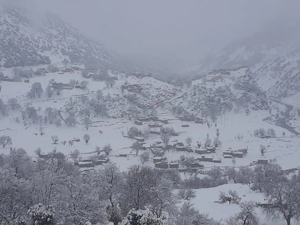
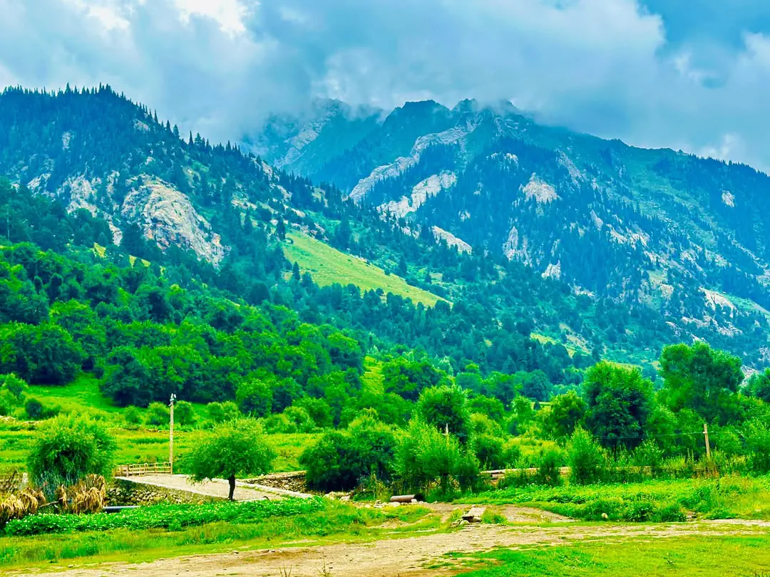
The Parun valley in summer, green on the meltwater of the snow above it. The photograph at the top of the page is Kantiwa in winter. Both are our own.
When the weather kills
Steep valleys, deep snow and summer cloudbursts are a dangerous combination. Four recent disasters, by date.
5 February 2017
Avalanche
An avalanche struck the village of Afsay in Bargi Matal at one in the morning after heavy snow, killing at least 57 people and injuring 33. The same storm destroyed houses and shops in Parun.
28 July 2021
Flash flood
A flood came down on Mirdesh in Kamdesh district. The Afghan Red Crescent had recovered 113 bodies by 31 July, and 173 houses and seven bridges were destroyed; the Red Cross later put the dead at more than 260.
19 February 2024
Landslide
After heavy snow a landslide buried part of the village of Nakre in the Tatin valley, killing 25 people.
20 July 2026
Flash flood
A flood struck Parun in the afternoon, destroying and damaging dozens of houses. Our article on the flood has the figures and how to help.
There is no study of Nuristan on its own. For the country as a whole, an analysis of the years 1951 to 2010 found that Afghanistan warmed by 1.8 degrees, and by as much as 2.4 in the east. The same study found heavy rain between March and September increasing by a quarter or more along the Pakistani border, though the trend was not statistically firm.
The best time to visit Nuristan
For most visitors the best months are June, September and early October. The roads are open, the high valleys are free of snow, and the weather is at its driest and steadiest. June is green, with the rivers still full; September and early October have the clearest skies and the harvest.
Late July and August are the warmest weeks and the valleys are at their finest, but they are also the season of thunderstorms and flash floods, so plans need slack in them and nobody should camp or park in a stream bed. April and May are beautiful and wet, with the high roads still blocked. From November to April, travel to the upper valleys depends on the snow and is not something to plan around.
Whatever the month, pack for a wide range. A July day in Parun can be 25 degrees and the night 10, and the drive from Asadabad up to Parun takes you from a hot plain to a cool mountain valley in a few hours.
Asked about Nuristan's weather
Does Nuristan get snow?
Yes, a great deal. Snow falls in the high valleys from November to April, on about sixty days a year around Parun by the weather models, and two and a half metres lay on the ground in Bargi Matal in February 2017. The lower valleys in the south get much less.
What is the climate like in Nuristan?
A mountain climate with cold, snowy winters and warm summers. Late winter and spring are the wettest time, autumn is dry, and the east of the province gets thunderstorms from the edge of the Indian monsoon in July and August. Temperature depends mostly on height, and the valleys range from about 1,000 to nearly 3,000 metres.
How cold does Nuristan get in winter?
At Parun, about 2,500 metres up, a January day averages about -2°C and the night about -10°C, with the coldest nights near -20°C. These are modelled figures, as there is no weather station in the province. The lower valleys are several degrees milder.
What is the best time to visit Nuristan?
June, September and early October, when the roads are open and the weather is driest. Late July and August are warm and green but bring thunderstorms and a risk of flash floods. From November to April the high valleys are under snow.
What is the altitude of Nuristan?
The province runs from about 980 metres, where the Alingar river leaves it, to about 6,250 metres on its northern divide, and three-quarters of it lies above 3,000 metres. Parun, the capital, is at about 2,500 metres; published figures range from 2,265 to 2,756.
Does Nuristan get the monsoon?
Its edge. The east and south-east of the province get summer thunderstorms from the Indian monsoon in July and August, which is why those valleys are forested. The north behaves more like Chitral, with dry summers.
What is the weather in Nuristan today?
We do not publish a forecast, and no weather station reports from inside the province. Forecast websites that show Nuristan are giving a computer model's estimate for a point on the map, which can be several degrees out for a particular valley. Use them for the trend, and ask someone in the valley before you travel.
On this site
- How to get to Nuristan, road by road
- Tours of Nuristan with local guides
- Nature and wildlife of Nuristan
- Nuristan National Park
- The Nuristan flood of July 2026
- Parun, the capital, at 2,500 metres
- Nuristan Updates, month by month
- The ten districts, with the map
- ERA5 reanalysis, 1991 to 2020, through the Open-Meteo archive (the modelled monthly figures)
- NOAA: climate normals for Jalalabad (measured, 1959 to 1983)
- NOAA: climate normals for Dir, Pakistan (measured)
- NOAA: climate normals for Chitral, Pakistan (measured)
- Aich and others, Climate change in Afghanistan deduced from reanalysis and coordinated regional climate downscaling (Climate, 2017)
- ICIMOD: The Status of Glaciers in the Hindu Kush-Himalayan Region, Indus basin
- ICIMOD: Afghanistan's first comprehensive glacier database
- OCHA: Nuristan avalanche flash update (8 February 2017)
- FloodList: the Kamdesh flood of July 2021
- Voice of America: the Nakre landslide (February 2024)
- Pajhwok Afghan News: Nuristan's roads closed by winter snow (2013)
- FEWS NET: Afghanistan seasonal monitor
Plan your Nuristan journey
Ready to plan a visit, source Nuristani products, or discuss an investment? Your message goes to Obaid, who is from Nuristan, and his team in Afghanistan and the UK. We reply to every message.