Skip to content
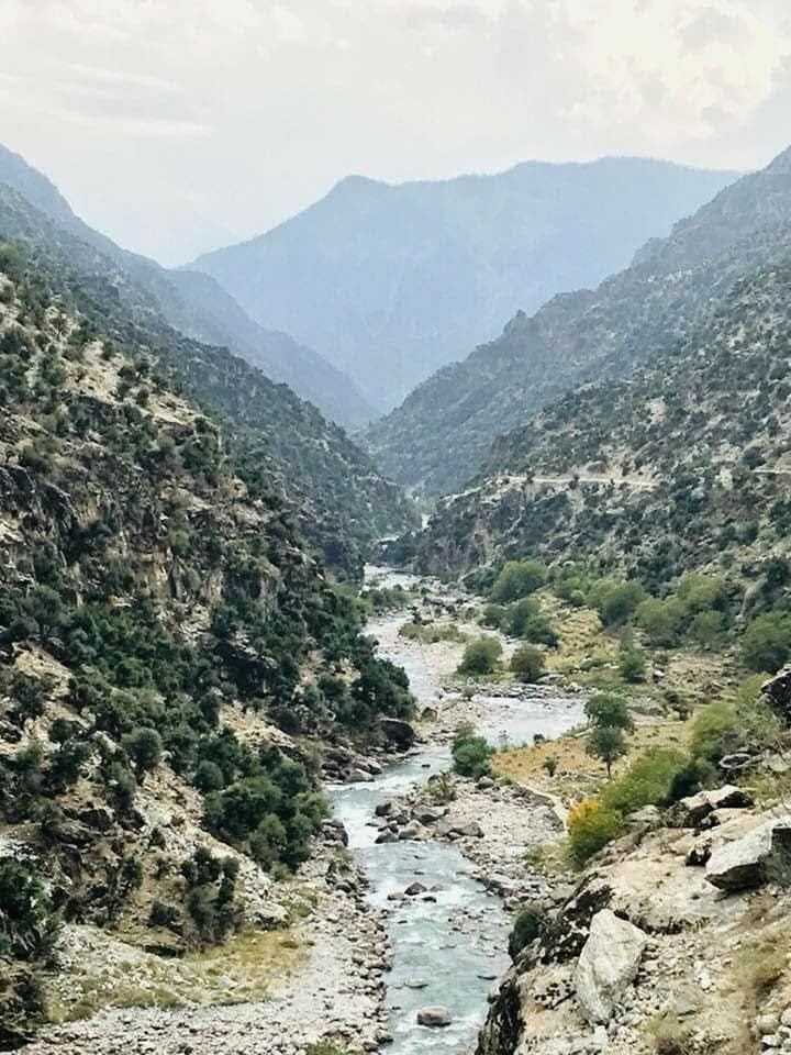
A river winding through a steep valley in the Hindu Kush, Nuristan
Getting there

How to get to Nuristan

Close to Kabul on the map and two days away on the ground. The three roads in, the journey step by step, and what to know before you go.

Where it is

Near, and not near

Nuristan is close to Kabul on the map and far from it on the ground. The province begins roughly a hundred kilometres east of the capital, but its valleys open to the south and east, into Laghman and Kunar, and there is no road over the mountains from the Kabul side. Every journey in goes around: east along the Kabul river to the plains, then north up one of three river valleys into the hills.

That is why a trip to Parun takes two days rather than three hours. It is also why the province stayed so distinct for so long, and why the journey is part of the point.

From Kabul
About 100 km as the crow flies
By road
Two days to Parun, with a night on the way
Airport
None in the province. Fly to Kabul
Season
April to October
Vehicle
Four-wheel drive, local driver
Cash
No ATMs in Nuristan
Phone signal
Patchy, none in many side valleys
Nearest hospitals
Asadabad and Jalalabad
The roads

Three roads in

Every route into Nuristan follows a river up from the plains. Which one you take depends on which districts you want to reach.

From Asadabad, the capital of Kunar

The Pech valley road

Serves Wama, Waygal and Parun

The main road into the heart of the province. It follows the Pech river west from Asadabad through Nangalam, where the Waygal valley branches off to the north, then on to Wama and up to Parun. This is the way most visitors reach the provincial capital, and the road that was cut in places by the July 2026 flood.

From Asadabad, north along the Kunar

The Kunar river road

Serves Kamdesh and Bargi Matal

For the eastern districts the road runs north up the Kunar river towards the Pakistani border, then turns west up the Bashgal valley to Kamdesh and on to Bargi Matal at its head. This is Kati and Kom country, the valleys that Robertson described in the 1890s and the setting of the tiered timber villages.

From Mehtar Lam, the capital of Laghman

The Alingar valley road

Serves Nurgaram, Mandol and Du Ab

The western districts are reached from Laghman, up the Alingar river past Nurgaram into the pine forests and gorges of Mandol and Du Ab. Lower and warmer than the Parun side, this is the doorstep of the province and the shortest way to Nuristani ground from Kabul.

The journey

Step by step from Kabul

  1. Fly to Kabul

    There is no airport in Nuristan and no reliable commercial flight closer than Kabul. Land in the capital, rest a night, and let our team collect you. If you want to see Kabul first, we build a day for it.

  2. Kabul to Jalalabad

    About 150 kilometres east on the Kabul to Jalalabad highway, down through the Kabul gorge and past Surobi to the warm plains of Nangarhar. Allow three to four hours with stops. Some travellers stay the night in Jalalabad; others push on.

  3. Jalalabad to Asadabad, or Mehtar Lam

    For the Pech and Kunar routes, continue north to Asadabad along the Kunar river, around two hours. For the western districts, turn instead to Mehtar Lam in Laghman. Either town is the last place with a bank, a proper hospital and a reliable phone signal.

  4. Into the valleys

    From here the road becomes a mountain road: unpaved for long stretches, cut into the valley side, crossing side streams on fords and small bridges. Progress is slow and depends on the season. From Asadabad, allow a full day to Parun. Wama and the lower Waygal are closer; Bargi Matal is further.

  5. The last stretch on foot

    Many villages sit above the road, reached by paths that climb the valley side. This is where the province reveals itself, and where our guides, who have family in these villages, make the difference between passing through and being welcomed.

Before you go

What to know

Plain answers to the practical questions. Where we say ask us, we mean it: conditions change month to month and we would rather tell you the truth for your dates than print a rule that will be out of date.

When to go

April to October, when the passes are open and the weather suits travel. Late spring is green and loud with meltwater; autumn is clear and cold with the walnut harvest under way. July and August bring the monsoon to the eastern Hindu Kush and with it the risk of flash floods, so we watch the forecasts closely and change routes when we must. Winter closes the high valleys.

Paperwork

You need a visa for Afghanistan, arranged before you travel. Movement between provinces can require permission letters from the authorities, and the rules change. Our team handles the local permissions and tells you exactly what to bring.

Vehicle and driver

A four-wheel drive with a driver who knows the road. This is not a place for a hire car. Our drivers are from the region and drive these valleys every month.

Money

There are no ATMs in Nuristan and cards are useless beyond Jalalabad. Carry what you need in afghanis, in small notes, and keep it in more than one place.

Phone and internet

Mobile coverage reaches the district centres and the main valleys and disappears in the side valleys. Tell people at home to expect silence for days at a time. Download maps before you leave Kabul.

Where you sleep

Simple guesthouses in the district centres, homestays with families that our team arranges, and tents in the high country. Parun's hotels were badly hit by the 2026 flood, so ask us what is open.

Food and water

You will eat what the valleys grow: bread, rice, beans, dairy, walnuts, and meat when a household is honouring a guest. Treat all water by boiling or filtering. Bring anything you cannot do without.

Health

The nearest proper hospitals are in Asadabad and Jalalabad, a day away from the high valleys. Carry your own medication and a first-aid kit, be honest with us about your fitness, and buy insurance that covers Afghanistan and evacuation.

Questions

Asked before every trip

How far is Nuristan from Kabul?

About a hundred kilometres in a straight line, but there is no road over the mountains from Kabul, so the journey goes east to Jalalabad and then north into the valleys. Allow two days to reach Parun, with a night in Jalalabad or Asadabad.

Can you fly to Nuristan?

No. There is no airport in the province. Fly to Kabul and travel the rest by road.

Is it safe to travel to Nuristan?

Afghanistan is quieter than it has been for decades, but every journey still needs care and honest planning. We arrange trips around the season and current conditions, travel with local guides and family networks, and will say plainly if a visit should wait. Check your government's latest travel advice before you commit.

Do I need a guide?

Yes. The roads, the permissions and the welcome all depend on someone who knows the valleys. Our guiding team is from Nuristan and has family in the villages you will pass through.

What is the best month to visit?

May, June, September and early October are the most reliable: the passes are open, the rivers are manageable and the monsoon rains of July and August have either not begun or have passed.

Which district should I visit first?

Parun if you want the provincial capital and the high country; Kamdesh if you want the classic tiered timber villages; Waygal if you want carving and green valleys within a shorter drive. Ask us and we will match the district to the time you have.

Next

Plan it with people from the province

Our guiding team is from Nuristan and has family in the villages along every one of these roads. Tell us your dates and what you want to see, and we will build the route for the month you are travelling in.

Get in touch

Plan your Nuristan journey

Ready to plan a visit, source Nuristani products, or discuss an investment? Your message goes to Obaid, who is from Nuristan, and his team in Afghanistan and the UK. We reply to every message.