Nuristan National Park
Afghanistan's third national park: what was declared, what was not, and the forests and animals it was drawn around.
A national park on paper
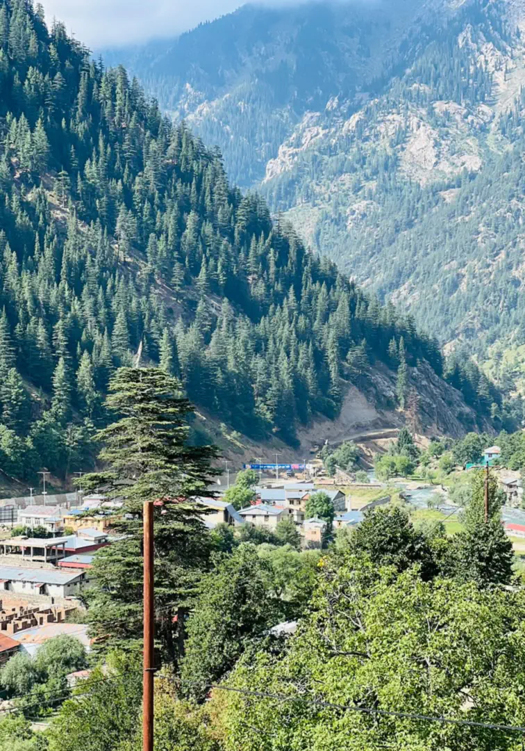
In June 2020 the Afghan government declared Nuristan a national park, the country's third after Band-e Amir and Wakhan. On paper it is one of the largest protected areas in Afghanistan. On the ground, six years later, it has no gate, no rangers and no management plan. What it does have is the thing it was meant to protect: the largest forests left in Afghanistan, and the bears, markhor and leopards that live in them.
This page sets out what was declared and what was not, how big the park is (the official figures disagree), what the surveys have found in the forests, and what it means for the people who live there and for anyone thinking of visiting. We will update it as the park's status changes.
- Declared
- June 2020, by the National Environmental Protection Agency
- Status
- Declared, but not yet established in law
- Size
- 9,225 km² by the government's figure; 5,733 km² in the world database
- Rank
- Afghanistan's third national park
- Forest
- Holly oak, chilgoza pine, deodar cedar, spruce and fir
- Wildlife
- Asiatic black bear, markhor, snow leopard, musk deer
- First proposed
- 1981, by advisers to the UN's food and agriculture agency
- Facilities
- None
What was declared, and what was not
The park exists by declaration. It has not been made law, and nothing has been built or staffed.
The declaration was made at a World Environment Day event in Kabul in June 2020, attended by the president. The head of the National Environmental Protection Agency signed papers for four new protected areas: the forests of Nuristan, as a national park and wildlife reserve, and three other sites elsewhere in the country. The sources give the date as 5 June or 7 June.
A declaration is the first step, and the later ones have not been taken. The agency's own biodiversity strategy, completed in 2023, records Nuristan National Park as declared and as having boundaries, but as having had no consultation with the communities, no justification document, no management plan, no management on the ground and no establishment in law. It adds that none of Afghanistan's protected areas has yet been formally gazetted. The World Database on Protected Areas lists the park as a national park and wildlife reserve designated in 2020.
Since then the reports have been of things not yet done. In January 2023 there were no services for visitors, though a state company had made a first survey for hotels. In August 2024 local officials said that nothing had been built for the park. We have found no report, up to October 2026, of a management plan, a marked boundary or a ranger.
How big it is, and where
The official figures run from 5,733 to 9,267 square kilometres, depending on whether the whole province is counted.
There are three official figures for the park's size. The government's biodiversity strategy gives 9,225 square kilometres, which is the area of the whole province. The international snow leopard programme's report for 2020 says the same in other words: the entire province, 9,267 square kilometres. The outline held in the World Database on Protected Areas is smaller, 5,733 square kilometres.
By our reading of that outline, about two-thirds of it lies inside Nuristan: nearly all of Wama, most of Parun and Kantiwa, about two-thirds of Bargi Matal, parts of Nurgaram, Du Ab and Mandol, and the edges of Kamdesh and Waygal. The remaining third is over the crest in the Kuran wa Munjan district of Badakhshan. So the park as drawn is the high, forested middle and north of the province, and it leaves out most of the lower Waygal and Bashgal valleys. A project document by the UN's food and agriculture agency, written in 2020, says frankly that the boundaries were not yet clearly identified.
The country inside it runs from valley floors at about 1,100 metres to peaks above 6,000. The tree line is at about 3,600 metres.
Oak, pine and cedar, by altitude
The last great forest in Afghanistan
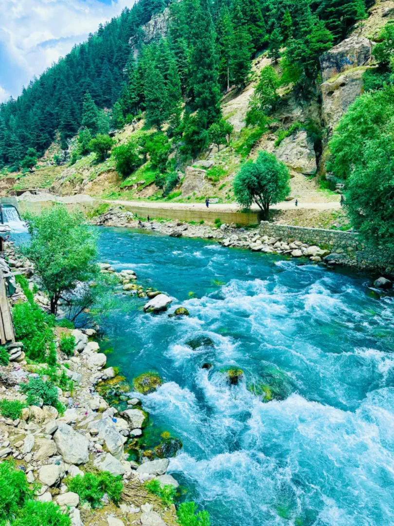
Afghanistan is a dry country, and closed forest grows only along its eastern edge, where the summer monsoon from India reaches far enough to bring rain. Nuristan is in the middle of that belt. The forest is stacked by altitude. Holly oak, called baloot, covers the lower slopes from about 1,200 to 2,200 metres. Above it comes the chilgoza pine, whose nuts are a harvest in themselves, up to about 2,500 metres. From 2,500 to 3,100 metres is the deodar cedar, the great timber tree of the Hindu Kush and the wood of every carved house in Nuristan. Spruce and fir climb to 3,300 metres in the wetter valleys, and juniper takes over in the dry ones. Walnut, wild almond and mulberry grow around the villages.
It is a forest much reduced. Afghanistan had about 3,600 square kilometres of closed forest in the 1970s. A United Nations study of satellite images found that Nuristan lost 53 per cent of its forest cover between 1977 and 2002, and Kunar and Nangarhar lost heavily too. In the 1980s and 1990s up to two hundred lorries of timber a day went down the main road through Kunar, and in 2003 the count was still 25 to 50 a day; about two-thirds of the cedar was going illegally to Pakistan. Residents were still reporting timber smuggling from the eastern districts in 2026.
What lives there
Only one proper survey has been made. This is what it confirmed, and what has been confirmed since.
| Animal | Status | The evidence |
|---|---|---|
| Asiatic black bear | Vulnerable | Eighteen animals seen and 45 camera-trap photographs in the 2006 to 2009 survey. Nuristan is probably its main stronghold in Afghanistan. |
| Markhor | Near Threatened | The flare-horned wild goat of the cliffs, confirmed by the survey. About 350 were counted in western Nuristan in 1977. |
| Snow leopard | Vulnerable | Presence confirmed in Bargi Matal and Kamdesh, in the high north-east. |
| Common leopard | Vulnerable | Confirmed in Nuristan, according to the government's biodiversity strategy. |
| Kashmir musk deer | Endangered | Seen five times in 2009, the first confirmed sightings in Afghanistan since 1948. |
| Leopard cat, yellow-throated marten, rhesus macaque, crested porcupine, red fox | Not threatened | All recorded by the survey's camera traps and transects, along with a wolf or jackal that could not be told apart from its tracks. |
| Common palm civet | Not threatened | Photographed by the survey, the first record of the species in Afghanistan. |
| Ibex and urial | Near Threatened and Vulnerable | Ibex were seen in 1977 and the urial is known only from records of the 1960s. Neither was found by the survey. |
| Birds of the forest | Not threatened | Kashmir nuthatch, Himalayan monal, koklass pheasant, white-cheeked tit and Himalayan woodpecker, listed for the Pech and Waygal valleys from fieldwork in the 1970s. |
The survey was carried out by the Wildlife Conservation Society between 2006 and 2009 across 1,100 square kilometres of south-central Nuristan, with 368 kilometres of walked transects and 901 camera-trap nights. It did not find snow leopard, common leopard, lynx, ibex, urial or brown bear in its own study area; the leopards and the musk deer were confirmed separately. Status is the species' category on the international Red List.
Fifty years of proposals
The idea is nearly fifty years old. In 1977 two wildlife advisers to the UN's food and agriculture agency, Petocz and Larsson, spent six weeks in western Nuristan studying the markhor and counted about 350 of them. In 1981 two more, Sayer and van der Zon, proposed a Nuristan National Park centred on the Parun and Kantiwa valleys, for its monsoon forests, its black bear, markhor and leopards, and the way of life of its people.
Then came forty years in which nothing could be done. As late as 2014 the government's own strategy described the park as a proposal without formal recognition. The declaration of 2020 was the first official act, and it remains the only one.
The valleys inside the park
A park with 175,000 people in it
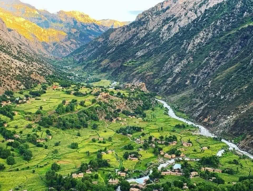
About 175,000 people live in Nuristan, and by custom the forests and pastures belong to its villages: each valley knows which slope is whose, who may graze where and who may cut. Afghanistan's environment law requires protected areas to be managed together with the communities inside them, and that was the stated intention for Nuristan. The government's own record is that the consultation never took place.
Money was promised at the time: thirty million dollars over five years across the four new sites by one report, a first project of half a million, and a volunteer environmental police. None of it is confirmed as spent. A project of the UN's food and agriculture agency in Parun and Wama, planned for 2021 to 2025, included the surveys needed to justify the park; we could not confirm that they were completed. When villagers were asked what threatened their forests and pastures, they named hunting, overgrazing, the felling of trees, the taking of rangeland and flash floods.
Our own view is a simple one. A park in Nuristan will work only if the valleys run it, because nobody else can. The people who lose most when the forest goes are the ones who live under it. Floods and landslides killed people in Nuristan in 2021, 2024 and 2026, and a bare slope holds far less water than a wooded one.
Afghanistan's national parks
Three national parks have been declared, with a protected landscape in Bamyan beside them.
| Area | Kind | Declared | Size |
|---|---|---|---|
| Band-e Amir | National park | 2009 | 613 km² |
| Wakhan | National park | 2014 | 10,950 km² |
| Nuristan | National park and wildlife reserve | 2020 | 9,225 km² (5,733 km² in the world database) |
| Bamyan Plateau | Protected landscape | 2019 | About 4,200 km² |
Can you visit Nuristan National Park?
There is nothing to visit as a park: no entrance, no visitor centre, no marked trails and no park accommodation. What a visitor sees is Nuristan itself, its valleys, villages and forest, which is what the park was drawn around. The road from Asadabad in Kunar to Parun is 108 kilometres; more than half of it was unpaved in 2020, and stretches have been repaired since.
Travel here needs local knowledge. The valleys are private country in the sense that every pasture and wood belongs to someone, and a guest travels with a host. Our guides are from these valleys. Check the current travel advice of your own government before you plan, and come in June, September or early October, when the roads are open and the weather is driest.
Asked about Nuristan National Park
Is Nuristan a national park?
Afghanistan's National Environmental Protection Agency declared Nuristan a national park and wildlife reserve in June 2020. It has not been established in law since, and it has no management plan, staff or facilities, so it is a national park by declaration only.
When was Nuristan National Park established?
It was declared in June 2020, at a World Environment Day event in Kabul; sources give 5 June or 7 June. A national park in Nuristan was first proposed in 1981.
How big is Nuristan National Park?
The government's figure is 9,225 square kilometres, which is the whole province. The outline recorded in the World Database on Protected Areas covers 5,733 square kilometres, mostly the high centre and north of Nuristan with part of neighbouring Badakhshan.
How many national parks does Afghanistan have?
Three: Band-e Amir in Bamyan, declared in 2009; Wakhan in Badakhshan, declared in 2014; and Nuristan, declared in 2020. They are among nine protected areas declared by the environmental agency.
Can you visit Nuristan National Park?
You can visit Nuristan, with local guides, but the park has no entrance, staff or facilities of its own. Visitors travel through the valleys and stay in the villages.
What trees grow in Nuristan's forests?
Holly oak on the lower slopes, chilgoza pine above it, deodar cedar from about 2,500 to 3,100 metres, and spruce and fir higher still in the wetter valleys, with juniper in the dry ones and walnut around the villages.
On this site
- Nature and wildlife of Nuristan
- Parun, the district at the centre of the park
- Kantiwa, the valley west of Parun
- Wama, on the Pech below the park
- Bargi Matal, the upper Bashgal, mostly inside the park outline
- Nuristan weather and climate, season by season
- How to get to Nuristan
- The Nuristan flood of July 2026
- Nuristani woodcarving and the cedar it depends on
- Support Nuristan
- National Environmental Protection Agency: National Biodiversity Strategy and Action Plan 2024 to 2030 (status of the protected areas)
- FAO: project document for community-based management in Nuristan (2020)
- Global Snow Leopard and Ecosystem Protection Program: country updates 2020, Afghanistan
- Radio Azadi: the announcement of the national park (8 June 2020, in Dari)
- Pajhwok Afghan News: Nuristanis on the lack of infrastructure despite national park status (6 August 2024)
- Radio Azadi: visitor services in Nuristan (January 2023, in Dari)
- Afghanistan's sixth national report to the Convention on Biological Diversity (forest belts, forest loss and the timber trade)
- Afghanistan's first National Biodiversity Strategy (2014), with the 1981 proposal for the park
- Stevens and others, Large mammals surviving conflict in the eastern forests of Afghanistan (Oryx, 2011)
- IUCN Red List: markhor
- ScienceDaily: the musk deer rediscovered in Nuristan (2014)
- BirdLife International: Pech and Waygal valleys Important Bird Area
- Mongabay: Afghanistan's protected areas and the Bamyan Plateau (2020)
The photographs on this page are our own, taken in Parun and Kantiwa.
Plan your Nuristan journey
Ready to plan a visit, source Nuristani products, or discuss an investment? Your message goes to Obaid, who is from Nuristan, and his team in Afghanistan and the UK. We reply to every message.