Skip to content
The Panjshir river running through its valley between bare mountainsides, with green fields along the water
Around the province

Nuristan's neighbours

Four Afghan provinces and one district of Pakistan touch Nuristan. What each one is, where it lies, and what it means to the valleys.

Over the mountains

A gateway, a gate, a wall, a roof, and family

Nuristan is ringed by mountains, and on the far side of them are four Afghan provinces and one district of Pakistan. Each is a different kind of neighbour. Kunar is the gateway, the province the eastern valleys depend on for their road, their bazaar and their hospital. Laghman is the western gate, the way in for the Alingar districts and the way every journey from Kabul begins. Panjshir is a wall, with no road across it and only summer passes on foot. Badakhshan is the roof, the main crest of the Hindu Kush and the lapis mines beyond it. And over the eastern passes lies Chitral, where many Nuristani families have relatives.

This page is the short version of all five, with the map to show where each one lies. Kunar and Chitral have pages of their own, linked from their sections; Laghman, Panjshir and Badakhshan are told in full here.

Borders
Four Afghan provinces and Pakistan
Longest border
Kunar, along the south and east
Roads in
Three, through Kunar and Laghman
Passes
Over the crest to Panjshir, Badakhshan and Chitral, on foot in summer
Rivers out
The Alingar to Laghman; the Pech and Landai Sin to Kunar
Nearest city
Jalalabad, by way of Asadabad or Mehtar Lam
Kabul
About 100 km away and two days by road
Nuristanis beyond the line
In Kunar, Laghman and Chitral
The map

Where each neighbour lies

Nuristan in the middle, its neighbours around it by true bearing. The neighbours' names on the map are links to their sections and pages.

ParunWaygalKamdeshBargi MatalWamaNurgaramMandolDu AbWantKantiwa
BadakhshanPanjshirLaghmanKunarChitral, Pakistan20 kmN
Tap a district to open its guide, or a neighbour's name to read about it. Boundaries via geoBoundaries, with our own lines for Kantiwa and Want; rivers from OpenStreetMap.
Nuristan's neighbours compared
NeighbourSideCapitalThe way there
KunarPashtun, with Nuristani, Pashai and Gujar minoritiesSouth and eastAsadabadDown the Pech or the Bashgal by road
LaghmanPashtun, Pashai and TajikWest and south-westMehtar LamDown the Alingar by road
PanjshirTajikWest and north-westBazarakNo road; summer passes on foot from the Ramgal and Kantiwa valleys
BadakhshanTajik and PamiriNorthFayzabadNo road; the main crest of the Hindu Kush, crossed on foot from the upper valleys
Chitral, PakistanKho, with the Kalash and Kati-speaking NuristanisEastChitral townNo open crossing; round by Torkham and Peshawar
South and east

The two with pages of their own

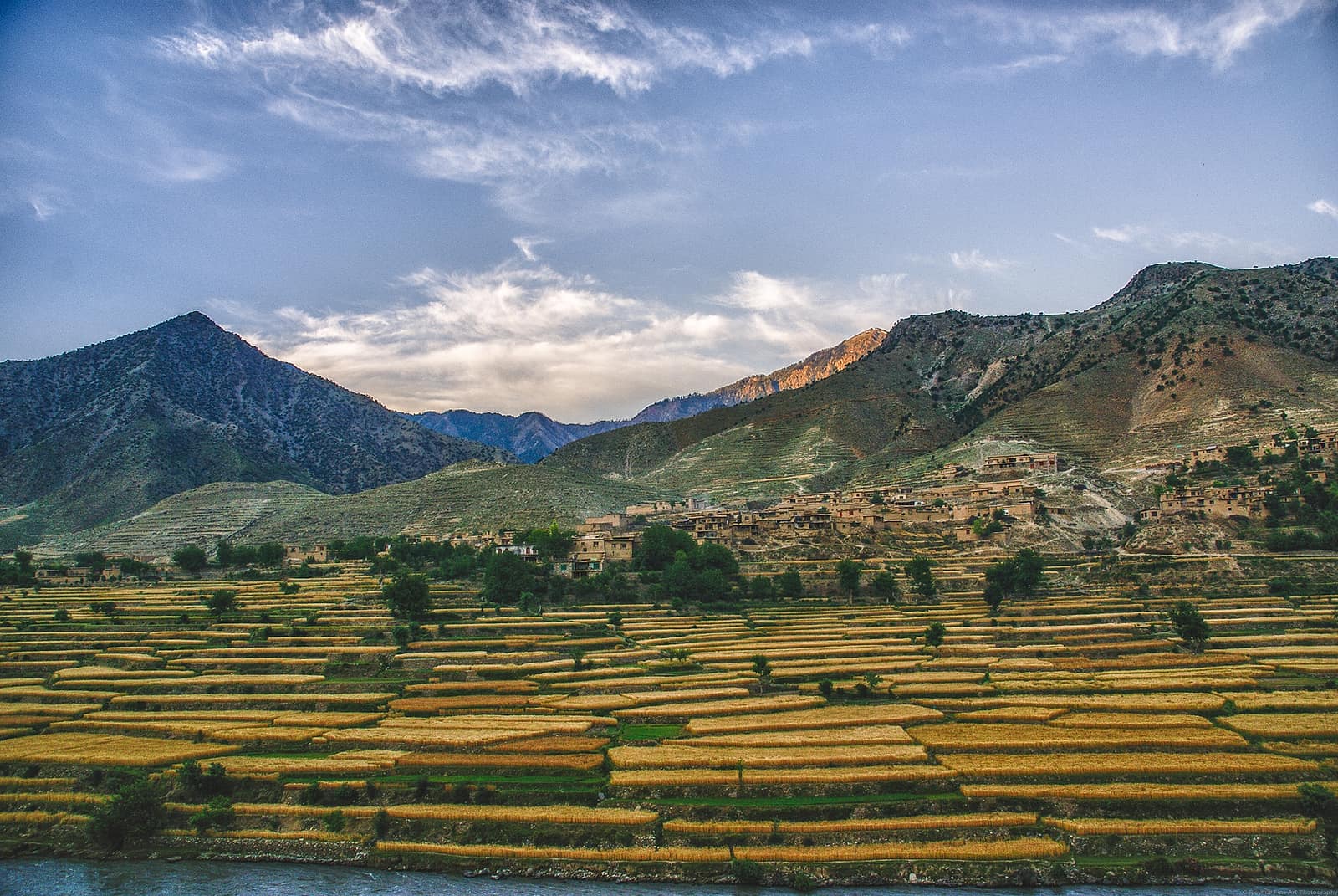
Golden terraced fields above the Kunar river with a hillside village in Nari district
Kunar, the gateway

Where the roads and the rivers go

Kunar lies below Nuristan's eastern valleys along the Kunar river, which comes down from Chitral and takes in the Landai Sin from the Bashgal and the Pech from Parun and Waygal before it reaches Jalalabad. Asadabad, its capital, stands where the Pech meets the Kunar, 80 kilometres from Jalalabad, and two of the three roads into Nuristan start there. Kunar is where Nuristan's timber, walnuts and morels are sold and where its people go for a hospital or a bank, and for a thousand years before 1896 it was the frontier of Kafiristan. The Tregam valley's three villages and other Nuristani communities lie on Kunar's side of the line.

Read the Kunar page
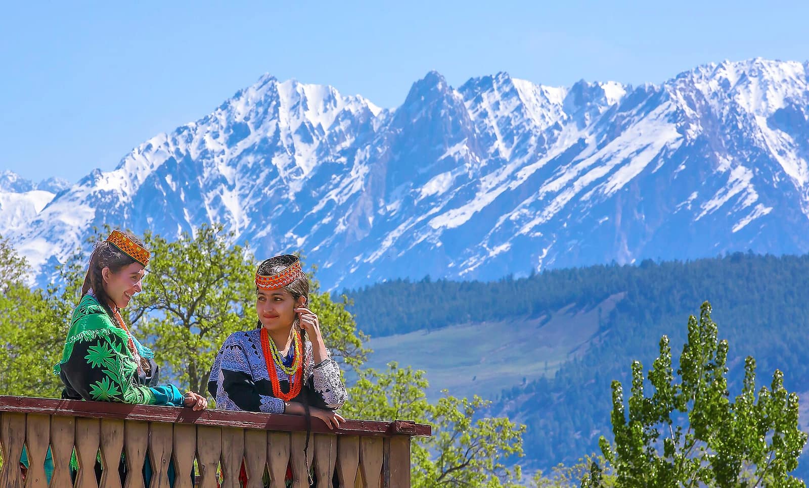
Two Kalash women in embroidered dresses and beaded headdresses before the snow peaks of Chitral
Chitral, the cousins

Over the eastern passes

Chitral, over the eastern passes, is in Pakistan, and its relationship with Nuristan is the closest of all. The Kalash of its three western valleys keep a religion related to the one Nuristan lost in 1896, Kati-speaking Nuristani families have lived in Chitral since their great-grandparents fled the conquest, and Waygal remembers many of its own people crossing the same way. The Chitral river becomes the Kunar, the Kalash valleys run up towards the Bashgal, and the pakol came into Nuristan from there. The border is not open to travellers; the way round is by Torkham and Peshawar.

Read the Chitral and Kalash page
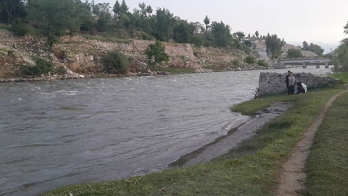
The Alingar river running wide and shallow between stony banks and green fields in Laghman
Laghman, the western gate

Down the Alingar

Laghman is the province to Nuristan's west and south-west, 3,843 square kilometres with about 502,000 people in 2021, in five districts: Mehtar Lam, Qarghayi, Alingar, Alishing and Dawlat Shah. Its capital, Mehtar Lam, takes its name from a tomb that tradition holds to be that of Lamech, the father of Noah, built over the supposed grave by Mahmud of Ghazni. Alexander's historians knew the country as Lampaka. About half its people are Pashtun, a fifth Tajik, and more than a quarter Pashai, the people of the side valleys whose languages, Indo-Aryan cousins of the Nuristani ones, are spoken by a third of the province.

Two rivers come down into Laghman from the mountains, the Alishing and the Alingar, and the Alingar is Nuristan's. It gathers the streams of Mandol and Du Ab, runs south through Nurgaram, crosses into Laghman's Alingar district and joins the Kabul river below Mehtar Lam. The road up it is the third of the three roads into Nuristan, and the way to the province's western districts: from Mehtar Lam up the Alingar past Nurgaram into the pine forests and gorges of Mandol and Du Ab. Lower and warmer than the Pech side, it is the road for the province's walnut and gem country.

Every journey to Nuristan from Kabul crosses Laghman, because the Kabul to Jalalabad highway runs through its southern district of Qarghayi, and the turn north to Mehtar Lam is where the Alingar route leaves it. Nuristanis have settled in the Laghman lowlands for generations, and until the 1980s the western valleys of Nuristan were governed as part of Laghman, as the eastern ones were governed as part of Kunar. The Pashai of the Alishing and Alingar valleys were the Kafirs' nearest neighbours to the west, sometimes their allies and sometimes their rivals, and the two peoples still trade, marry and quarrel along the same valleys.

The Alingar in Laghman, the same water that leaves Nuristan below Nurgaram.
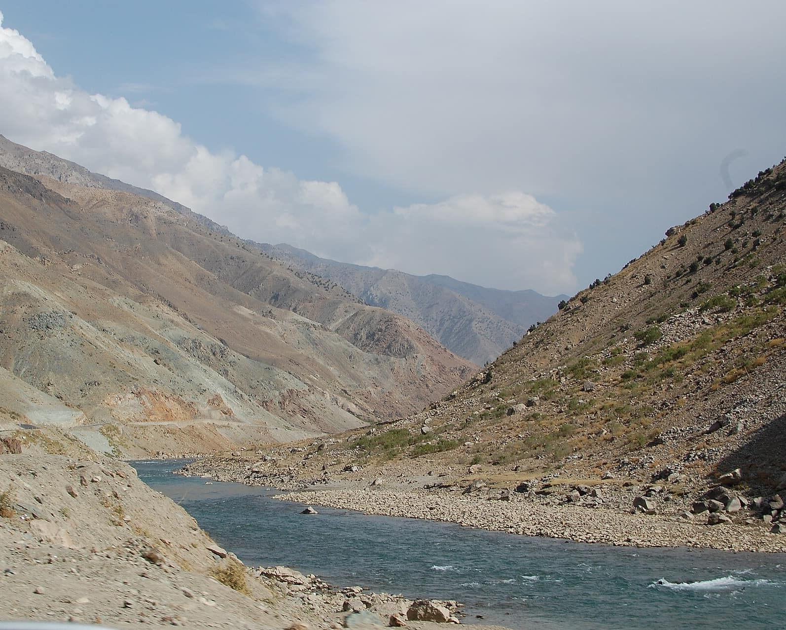
Panjshir, the wall

A crest of peaks and no road

Panjshir is the valley to Nuristan's west and north-west: 3,771 square kilometres with about 335,000 people in 2021, almost all of them Tajik and Dari-speaking, in seven districts along the Panjshir river, with Bazarak as the capital. The river runs south-west out of the mountains to join the Ghorband and the Kabul river, and the valley is famous in Afghanistan for three things: its emeralds, dug from the hillsides above Khenj; its resistance, under Ahmad Shah Massoud against the Soviet army in the 1980s and again after 2001, and briefly after the Taliban took Kabul in 2021; and the Anjuman pass at its head, the old road over into Badakhshan.

Between Panjshir and Nuristan there is no road at all. The two provinces meet along a crest of peaks, Mir Samir among them at 5,768 metres, and the only ways across are summer passes on foot from the heads of Panjshir's Paryan district over into Nuristan's Kantiwa, Ramgal and Kulam valleys, the country of the western Kati. The best-known account of the crossing is Eric Newby's A Short Walk in the Hindu Kush, from 1958, which begins with a failed attempt on Mir Samir and ends among the villages of the Ramgal. Shepherds and, in the wars, fighters have used the passes; almost nobody else does.

The two provinces have less in common than Nuristan and Kunar or Nuristan and Chitral. Panjshir's people are Persian-speaking Tajiks with a history of their own, and the relationship is one of neighbours who nod across a wall. Its lapis-blue emerald trade and Nuristan's gemstones belong to the same mountain, though, and the mineral wealth that the Invest page describes runs under both.

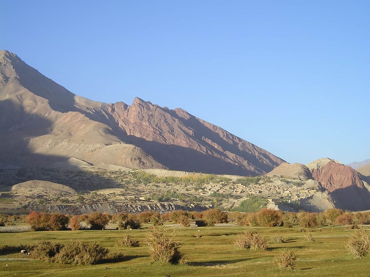
The broad, bare Kuran wa Munjan valley in Badakhshan under high mountains, looking west
Badakhshan, the roof

Over the crest, the lapis

Badakhshan is the roof. It is the province north of Nuristan, and the border between them is the main crest of the Hindu Kush: the peaks that Bargi Matal, Parun and Mandol look up at are on that line, and on the far side the streams run north to the Kokcha and the Amu Darya instead of south to the Kunar and the Kabul. Badakhshan is enormous, 44,835 square kilometres with about 1.1 million people, mostly Tajik with Pamiri peoples in its high eastern valleys, and it reaches along the Wakhan corridor to the border of China. Its capital is Fayzabad, far to the north.

The part of Badakhshan that touches Nuristan is its remotest: the district of Kuran wa Munjan, the valley of the Munjan river, where the Munji language, a Pamiri language of the Iranian family, is spoken. Above it, at Sar-e Sang, are the lapis lazuli mines that have been worked for six thousand years, the source of the blue in Egyptian tombs, Renaissance paintings and, as it happens, the colour this site uses for its links. The mines lie a mountain range from Parun, and the old tracks over the crest were how lapis and, in the other direction, Kafir raiders occasionally crossed. There is no road between the two provinces and there never has been.

From Chitral, the Dorah pass leads into Badakhshan around the end of the Nuristan crest, and it was by that way, and by the Anjuman pass from Panjshir, that the three provinces around Nuristan's high country were joined before roads. For a visitor to Nuristan, Badakhshan is the skyline: the snow on the northern peaks that stays all summer above Parun is Badakhshan's side of the mountain.

The Munjan valley, Badakhshan's side of the mountain above Parun and Bargi Matal.

Questions

Asked about Nuristan's neighbours

Which provinces border Nuristan?

Four Afghan provinces: Kunar to the south and east, Laghman to the west and south-west, Panjshir to the west and north-west, and Badakhshan to the north. To the east, along the crest of the Hindu Kush, Nuristan borders the Chitral district of Pakistan.

Does Nuristan border Pakistan?

Yes. Nuristan's eastern edge, above the Bashgal valley in Kamdesh and Bargi Matal districts, is the border with Pakistan's Chitral district, fixed as the Durand Line in 1893. There is no crossing open to travellers; the passes that once joined the Bashgal to the Kalash valleys are closed.

Is there a road from Nuristan to Panjshir or Badakhshan?

No. Nuristan's roads all run south and east, into Laghman and Kunar. Panjshir and Badakhshan lie over the main crest of the Hindu Kush, and the only ways across are summer passes on foot, used by shepherds and, in the past, by traders and raiders.

What is the nearest city to Nuristan?

Jalalabad, the capital of Nangarhar, about 80 kilometres by road from Asadabad in Kunar and a similar distance from Mehtar Lam in Laghman. Asadabad and Mehtar Lam are the nearest towns with a hospital, a bank and reliable phone signal; Kabul is about a hundred kilometres away in a straight line and two days by road.

Which neighbours have Nuristani communities?

Kunar, where the Tregam valley's three villages speak Tregami and other Nuristani languages are spoken along the lower Pech; Laghman, where Nuristanis have settled in the lowlands for generations; and Chitral in Pakistan, where more than 12,000 Kati speakers descend from families who fled the conquest of 1896.

Where do Nuristan's rivers go?

All of them south, into the Kabul river and so to the Indus. The Alingar runs through Laghman to join the Kabul river below Mehtar Lam; the Pech and the Landai Sin join the Kunar in Kunar province, and the Kunar meets the Kabul river at Jalalabad. Nothing from Nuristan flows north; the streams on the far side of the crest belong to Badakhshan.

Get in touch

Plan your Nuristan journey

Ready to plan a visit, source Nuristani products, or discuss an investment? Your message goes to Obaid, who is from Nuristan, and his team in Afghanistan and the UK. We reply to every message.